
Last Updated: November 1, 2026
Quick Summary
Kansas City neighborhoods near parks and trails cluster along a green spine running from the Missouri River through Midtown and out toward the metro's edges, with the Plaza, Midtown, Brookside, and Waldo offering the strongest walkable park access. Walkability here is often block-by-block rather than neighborhood-wide, so the park within walking distance shapes daily life more than almost any other address detail.
- Missouri-side parks tend to sit inside a walkable street grid, while Kansas-side parks anchor longer trail networks.
- Plaza and Midtown residents reach Loose Park and Brush Creek Trail in under 10 minutes by car.
- Brookside and Waldo sit adjacent to the Trolley Track Trail with strong walk and bike access.
- A trail that looks continuous on a map can have gaps at major roads, so confirm crossings first.
- Walk the route from the front door to the park at the time of day you would use it.
Table of Contents
- Kansas City Neighborhoods Near Parks: What Locals Know
- Kansas City Walkable Neighborhoods for Park Access
- Kansas City Walking Trails and Where They Start
- Popular Parks and Green Spaces by Neighborhood
- Playgrounds, Sports Fields, and Family-Friendly Recreation
- Distances, Travel Times, and Trail Access Points
- Missouri Side or Kansas Side: Choosing by Lifestyle
- What to Check Before Choosing a Neighborhood Near a Park
- Frequently Asked Questions
Kansas City Neighborhoods Near Parks: What Locals Know
Kansas City neighborhoods near parks and trails cluster along a green spine that runs from the Missouri River down through Midtown and out toward the metro's edges. At Kansas City, we tell visitors the same thing we tell friends relocating here: the park within walking distance shapes daily life more than almost any other address detail. To experience these areas firsthand before deciding, consider a guided Kansas City neighborhood tour. A Kansas State University study on park availability and quality across Kansas City found that access to parks varies widely by neighborhood and income level, which makes choosing the right block worth real research.
Below, we break down which neighborhoods put you closest to green space, how the trail network connects them, and what to check before you commit to an area.
Kansas City Walkable Neighborhoods for Park Access
Walkability in Kansas City is uneven, and that is the honest starting point. Some neighborhoods let you leave the car parked for days; others require a short drive to reach the nearest trailhead.
Generally, the most walkable pockets of any city share a pattern: a grid street layout, a park or boulevard within a few blocks, and a commercial strip with coffee, groceries, and restaurants.
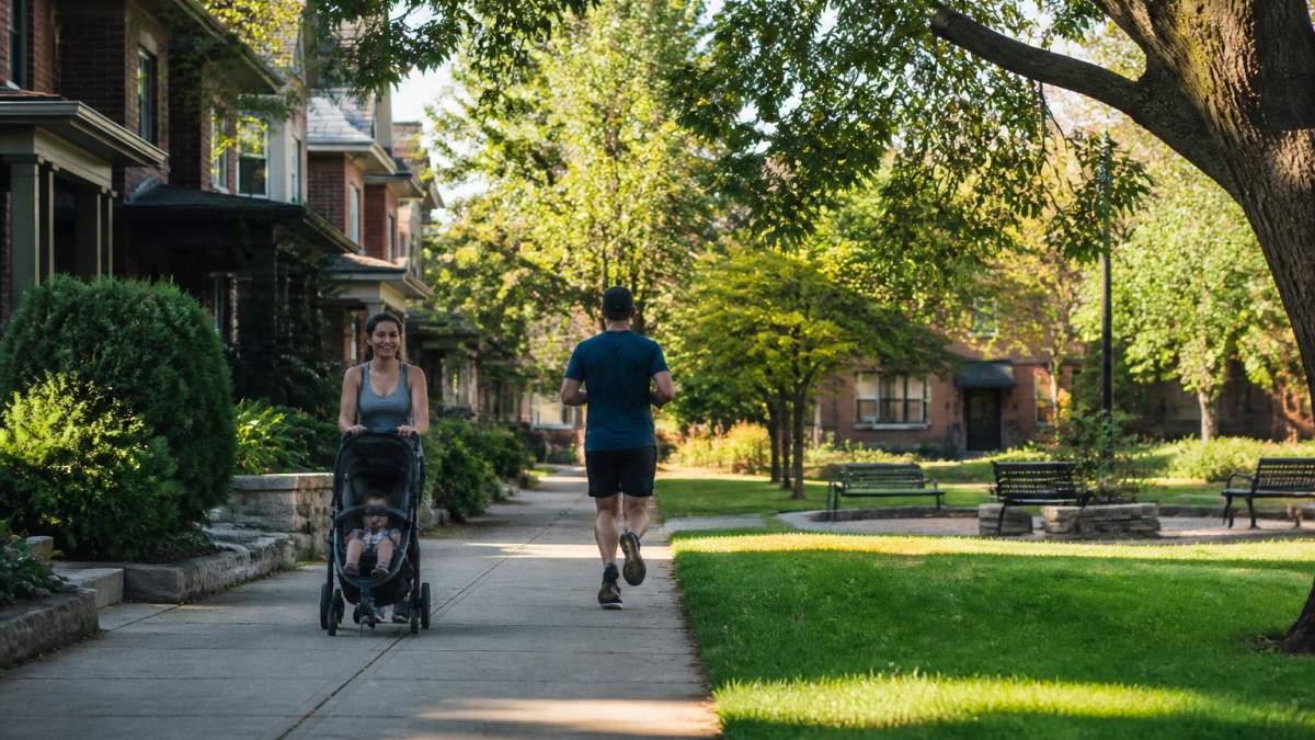
What most guides miss is that walkability here is often block-by-block rather than neighborhood-wide. A home two streets from a boulevard trail lives very differently from one on the far edge of the same ZIP code.
Kansas City Walking Trails and Where They Start
Kansas City walking trails radiate from a handful of anchor points, and knowing the trailheads saves you circling for parking. The useful detail is not just which trails exist but where they start, what surface they carry, and which neighborhoods feed into them.
How to pick a trailhead. Most trailheads sit near neighborhood commercial districts, which means you can pair a walk with coffee or lunch. Before a first visit, confirm the specific access point, whether there is a parking lot or only street parking, and whether the entrance connects directly to the trail or requires a street crossing.
Trail Conditions and Accessibility
Accessibility matters too, so check trailhead parking and paved approaches before you plan a visit with a wheelchair or mobility device. Confirm seasonal closures and maintenance windows with the managing agency before you go.
Popular Parks and Green Spaces by Neighborhood
The more useful exercise is pairing each green space with the neighborhoods that actually use it, because proximity on a map and proximity in daily life are different things. For a closer look at the area's top parks and gardens, see this Kansas City parks and attractions guide.
Playgrounds, Sports Fields, and Family-Friendly Recreation
Families should weight playground quality and field access as heavily as trail proximity. For a complete guide to Kansas City family attractions to plan outings, see this page. Neighborhood parks often include playgrounds, picnic shelters, and open fields, but check each park's amenities before you go.
A common mistake is assuming every park with a playground also has restrooms and shade. Check both before a summer outing with young kids.
Distances, Travel Times, and Trail Access Points
A park that looks close on a map may sit across a highway with no direct crossing, so check the route before you go.
| Neighborhood Area | Nearest Major Green Space | Typical Drive | Walk or Bike Access |
|---|---|---|---|
| Plaza and Midtown | Loose Park, Brush Creek Trail | Under 10 minutes | Strong, grid streets |
| Brookside and Waldo | Trolley Track Trail | Under 10 minutes | Strong, trail-adjacent |
| Downtown and River Market | Penn Valley Park, riverfront paths | Under 10 minutes | Good, some gaps |
| East Side | Swope Park | 10-15 minutes | Mixed, depends on block |
| Kansas-side suburbs | Indian Creek and county trails | 10-20 minutes | Varies by subdivision |
Travel times shift with rush hour, so test a commute or park run at the hour you would actually go.
Missouri Side or Kansas Side: Choosing by Lifestyle
If you want to walk to dinner and a park in the same evening, the Missouri side usually wins. For a breakdown of the best neighborhoods for a stay on either side, see this guide. If you want a long paved trail from your driveway and a bigger yard, the Kansas side fits better.
What to Check Before Choosing a Neighborhood Near a Park
Before signing a lease or making an offer, verify the details that listings gloss over. Readers close to committing can find practical moving-to-Kansas City guidance in this guide.
- Walk the route from the front door to the park at the time of day you would use it
- Confirm whether the park has restrooms, lighting, and published hours
- Check for a safe street crossing, not just proximity on a map
- Ask about flooding on low-lying trails after heavy rain
- Look up current park programming and any construction closures
- Visit on a weekend to gauge how busy the space gets
Conditions can change block by block, so talk to residents and check recent local reporting rather than relying on a single review.
Frequently Asked Questions
Which Kansas City neighborhoods are closest to parks and trails?
Neighborhoods bordering the city's larger parks generally give the shortest walk to green space. For trail access specifically, look at neighborhoods near trailheads along the city's creek corridors. Check the specific park boundary before you commit, since a block or two makes a real difference in daily walking distance.
What are the most walkable neighborhoods in Kansas City for park access?
Kansas City walkable neighborhoods tend to cluster around the older streetcar-era grid, where sidewalks are continuous and destinations sit close together. Neighborhoods with a grid street layout and nearby shops and restaurants often let you reach parks on foot. The key test is whether you can leave your front door and reach a park, a coffee shop, and a grocery store without crossing a highway ramp or a wide arterial road. Use a walk-score check plus one in-person walk at rush hour before deciding.
Where can you find walking trails in Kansas City and how do you check conditions?
Kansas City walking trails follow several creek corridors and connect many neighborhood parks, with paved multi-use paths for walking, running, and cycling. Trailheads are usually marked at park entrances, and most are open from dawn to dusk. Conditions vary by season: after heavy rain, low-lying creek sections can flood, and summer heat makes shade coverage important. Check the city parks department page for closures before you go, and look at the surface type, since crushed limestone and paved paths suit different users. Accessibility varies, so confirm paved, flat segments if you use a wheelchair or push a stroller.
What should you check before choosing a neighborhood near a park?
Start with the actual gate-to-gate distance, not the map pin. A park can be half a mile away but unreachable on foot if a highway or rail line sits between you. Check sidewalk continuity, street lighting, and crossing signals on the route you would walk after dark. Confirm what the park offers: playground, restrooms, sports fields, or just open lawn. Look at parking and event-day traffic if the park hosts festivals or races. Finally, visit at different times of day and on a weekend to see how the park is actually used, since a quiet weekday morning can look very different from a busy Saturday.
Choosing a neighborhood near a park sounds simple until you weigh walkability, trail surfaces, school routes, and the state line against each other. We built our local guides to make that comparison faster, with neighborhood breakdowns, attraction coverage, and trip planning grounded in how the city actually works. Get started with Kansas City and plan a visit or a move with recommendations you can check on the ground.
